Fall Storm To Bring Strong Winds Midweek
CHICAGO (CBS) -- The Windy City will live up to its nickname later this week, as a fall storm is expected to bring strong winds to the Chicago area starting Wednesday night, and continuing through the day Thursday.
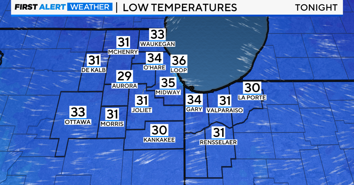
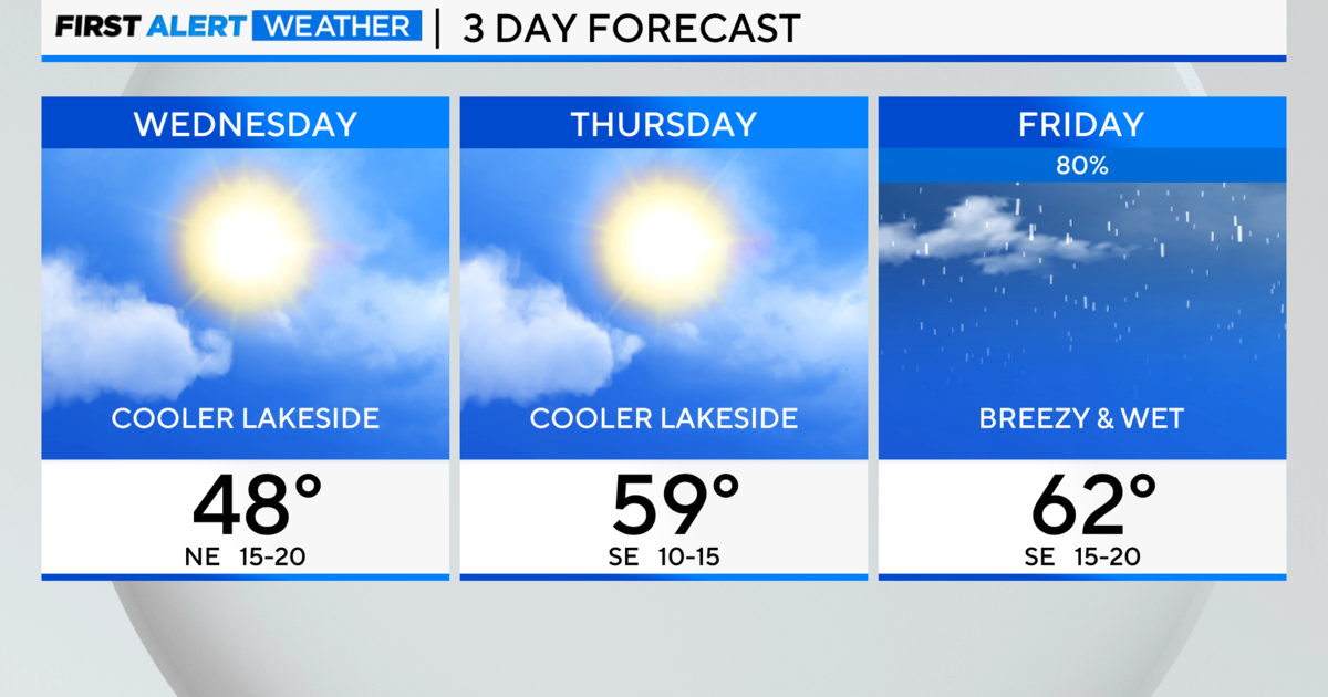
The week started off cold, but calm, with temperatures dipping into the 20s in some suburbs. Monday's high will reach about 55 degrees, and Tuesday and Wednesday will be a bit warmer than normal for early November, with highs in the upper 50s or lower 60s.
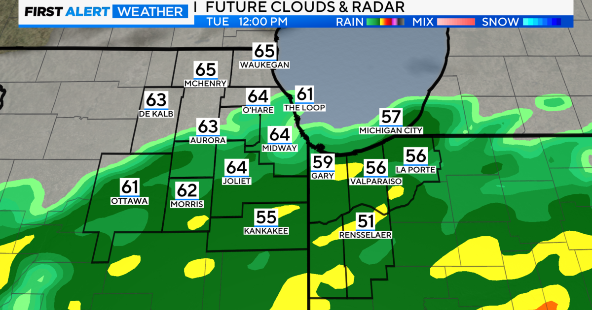
Then, Wednesday night, a strong fall storm will move in. The storm will bring minimal thunder and lightning for the Chicago area, but will include gusty winds and heavy showers. According to the National Weather Service, there is a slight chance of gusts up to 50 or 60 mph.
The greatest risk of severe storms Wednesday night is south of the Chicago area – in particular near St. Louis and near the far southern end of Indiana – but northern Illinois will still see the possibility of strong winds and heavy rain.
However, as a colder air mass moves in on Thursday, and while showers should end Thursday morning, the cold front will open the door for even stronger winds for Chicago. The National Weather Service said very strong winds are expected all day Thursday, and could make traveling difficult, and cause minor damage. The strongest winds likely will be Thursday morning, with gusts of up to 50 mph.
The storm also will usher in cooler weather, as temperatures on Thursday will reach only about 50 degrees, and Friday's high is expected to be only about 47.