Warm Start To Monday, But Storms And Cooler Temps Ahead
CHICAGO (CBS) -- A very warm start to the day on Monday will give way to showers and storms by the evening, and temperatures will linger below normal for the rest of the week after that system moves through.
The temperature in Chicago had already hit 64 shortly before 8 a.m., one degree warmer than the normal high for April 25, on the way to a forecast high of about 82.
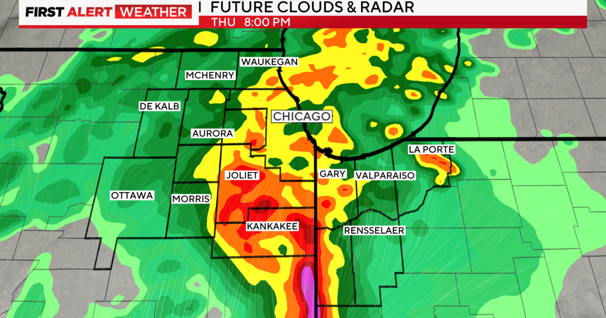
Scattered thunderstorms should move through in the late afternoon and early evening, bringing a slight risk of severe weather for most of northern Illinois and southern Wisconsin as well as Northwest Indiana. The main threat is from large hail and gusty winds.
According to the National Weather Service, the greatest risk for severe weather is from 5 p.m. to 10 p.m.
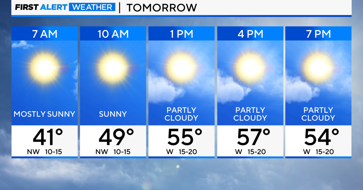
After the storms clear out late Monday night, temperatures will continue to fall through the day on Tuesday, when the daytime high will be in the mid to upper 50s.
That trend will continue through the end of the week, with highs ranging from the low to upper 50s each day, and overnight temperatures falling into the low 40s.
Wednesday and Thursday also will bring more chances for rain.