Strong Winds, Big Waves Will Accompany Cold Front
CHICAGO (STMW) - Strong winds and high waves along the Lake Michigan shore are expected to move into the Chicago area with a Thursday afternoon cold front.
A wind advisory is in effect from 4 p.m. Thursday until 5 a.m. Friday for Cook, DeKalb, DuPage, Kane, Kankakee, Lake, McHenry and Will counties, according to the National Weather Service's website. Sustained winds of 30 miles per hour and gusts up to 45 miles per hour are possible.
The advisory means winds of 35 miles per hour are expected, according to the weather service. Winds that strong can make driving difficult, especially for "high profile vehicles," and motorists are advised to use extra caution.
A cold front will move across the Chicago area Thursday afternoon with winds increasing from the northwest behind the front, the weather service said. The strong winds are expected to continue through at least Friday morning.
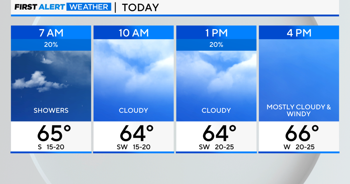
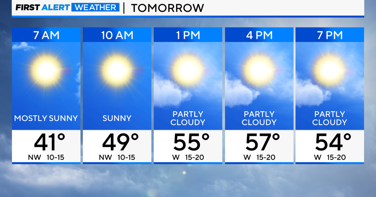
The weather service is predicting a high near 70 degrees Thursday with a 40 percent chance of showers. The temperature will fall near 50 degrees Thursday night and only rebound into the high-50s Friday, when there is a 20 percent chance of rain.
On Lake Michigan, the weather service is warning of a rip current risk from Thursday afternoon through Friday night. Aves could be 10 to 14 feet high on the Illinois coast and 12 to 16 feet high in Indiana.
Rip currents are powerful channels of water flowing quickly away from shore, the weather service said. People caught in a rip current should not panic and swim parallel to the shore until away from the force of the current, then swim back to the beach.
© Sun-Times Media Wire Chicago Sun-Times 2011. All Rights Reserved. This material may not be published, broadcast, rewritten, or redistributed.