Severe Thunderstorm Watch Issued For Afternoon
UPDATED 05/03/12 1:13 p.m.
CHICAGO (CBS) -- Bermuda shorts have been the perfect attire so far for Thursday, but severe thunderstorms could be breezing in later in the afternoon.
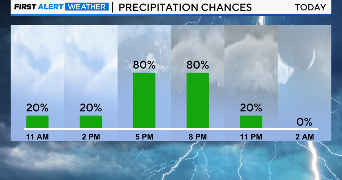
The National Weather Service has issued a severe thunderstorm watch is in effect until 7 p.m. for the entire Chicago area, as a frontal boundary sags south across Wisconsin.
Some storms could result in heavy rainfall or localized flash flooding, the Weather Service said.
In the first half of the day, conditions were warm, muggy and downright tropical. CBS 2 Meteorologist Megan Glaros reports as of 11:20 a.m., it was already 82 degrees at Gary, Ind.; 81 at O'Hare International Airport; and 79 at Midway Airport and at Waukegan.
The forecast high for the day is 84.
The overnight low is 65 with more storms possible, and as a cold front blows through, the high for Friday drops to a still-comfortable 75.
Sunshine returns over the weekend and through much of next week, but you'll need long pants and a spring jacket again. The high for Saturday is 67, Sunday 65, Monday 62, and Tuesday and Wednesday 60.

