Cooler Temperatures Take Over, Chance Of Rain Persists Through Saturday
CHICAGO (CBS) -- The worst of the severe weather is over now, but a chance of rain and even severe weather persists, and the temperate 80s are gone for the foreseeable future.
The severe storms overnight caused major damage in some areas. The brick façade crashed to the ground at St. James Armenian Church in downtown Evanston, and a tree fell on a home in Morton Grove.
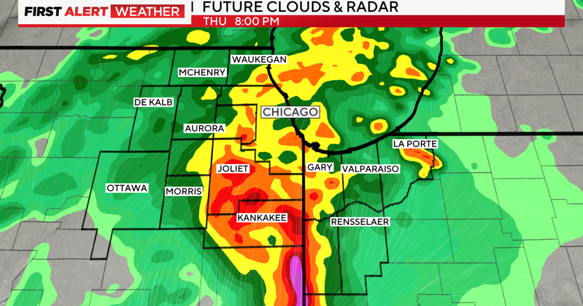
But a frontal boundary has sagged to the south of the Chicago area, leaving the storms far to the south near Peoria, and keeping the weather much cooler in most of Chicagoland.
As of 11:20 a.m., it was only 60 degrees at O'Hare International Airport and 65 at Midway, and a chilly 53 at Waukegan. But conditions were far warmer farther away from the lake; it was 74 in Kankakee and Joliet.
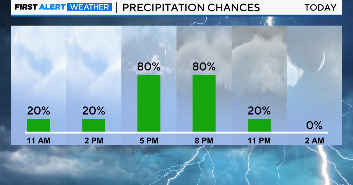
The area is still considered to be under slight risk of severe weather Friday, but most of the risk passed when the morning ended. Still, a chance of showers and thunderstorms remains as a stationary frontal boundary remains parked nearby.
The high for the day is 70 near the lakefront, and somewhat warmer for areas farther removed. Overnight, a 40 percent chance of storms persists, as temperatures drop to 54.
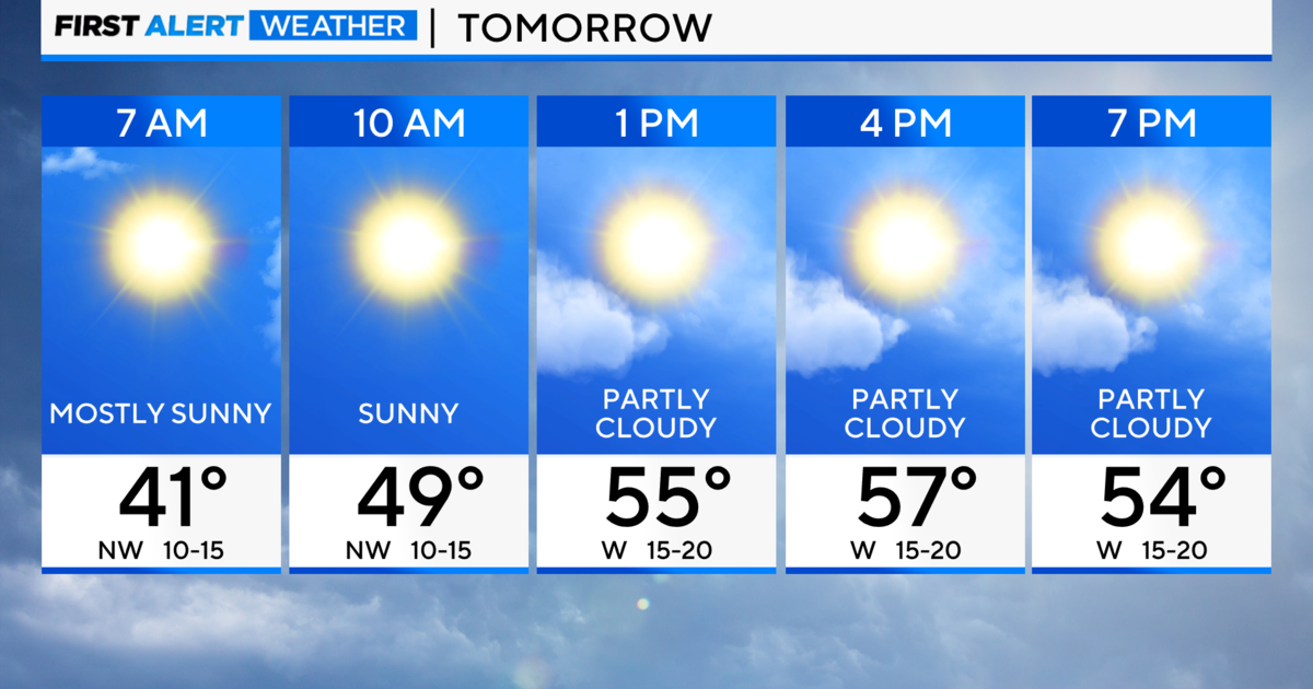
On Saturday, the high is 67 with a 30 percent chance of rain. But late on Saturday night, depending on conditions, the sky will be illuminated with a supermoon – the huge, yellow lunar disc that is seen when the full moon passes closest to the earth.
The supermoon will appear around 10:30 p.m. Saturday. Supermoons are about 14 percent larger and 14 to 16 percent brighter than the average full moon.
The high for Sunday is 66, Monday 65, Tuesday 60, Wednesday 61, and Thursday 64.
