Temperatures To Plunge Again, Will Stay Near Zero Most Of Week
CHICAGO (STMW) -- Though the polar vortex has returned north, temperatures in the Chicago area are expected to hover near zero throughout much of next week, with wind chills dipping as low as minus-25.
The temperature will start to fall Monday as a cold front will move into the area, said National Weather Service Meteorologist Ben Deubelbeiss. The high is expected to be in the 20s overnight and temperatures will drop steadily throughout the day. The day's low will be in the single digits, with wind chills between 15 and 25 degrees below zero.
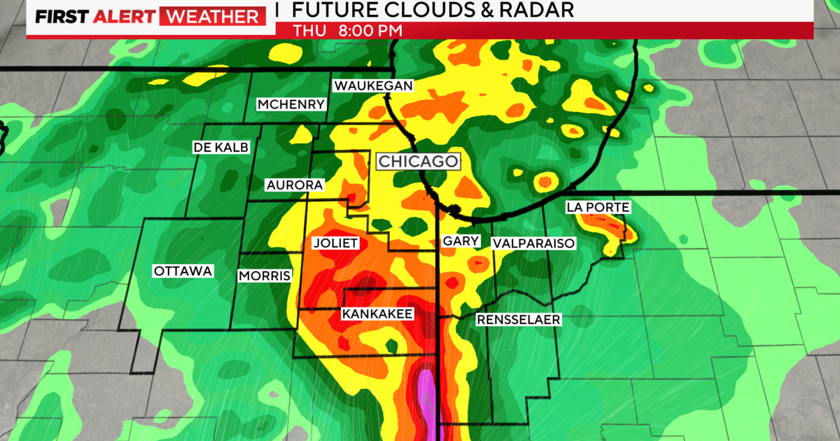
Tuesday, Wednesday and Thursday will have similar highs and lows, with temperatures near zero and double-digit wind chills, Deubelbeiss said. Starting Monday night, a narrow band of lake-effect snow could leave up to a foot of snow in parts of northwest Indiana.
This particular blast of cold air is not the polar vortex itself, but rather a byproduct of the system that regularly moves through Canada and into the United States, according to the weather service.
By Friday, highs in the area are expected to climb to 24 degrees, falling to 15 at night, forecasts show.
(Source: Sun-Times Media Wire © Chicago Sun-Times 2014. All Rights Reserved. This material may not be published, broadcast, rewritten, or redistributed.)