Heavy Snow Expected Tonight; Season Could Become 2nd Snowiest Ever
CHICAGO (CBS) -- Old Man Winter isn't quite done with Chicago yet. More than half a foot of snow could fall in the city Tuesday night through Wednesday morning.
The National Weather Service has issued a winter storm warning for most of the Chicago area from 10 p.m. Tuesday through 1 p.m. Wednesday.
Rain Tuesday evening should change to snow, with snowfall rates of up to 2 inches per hour at times overnight, and with wind gusts of up to 40 mph, some areas could experience blizzard conditions during the storm.
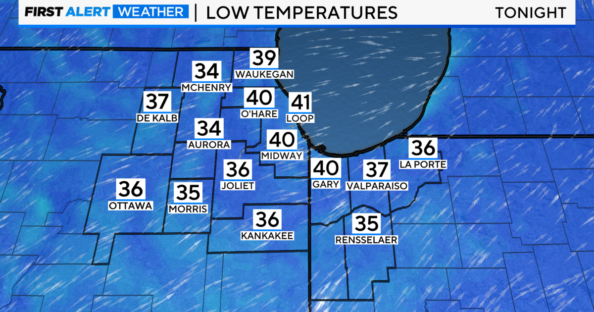
The winter storm also will send temperatures plunging from the mid 40s on Tuesday afternoon to the low 20s on Wednesday morning.
The heavy snowfall likely will snarl the morning rush on Wednesday, and could force airlines to cancel flights at O'Hare and Midway International Airports.
Snow accumulations could reach 4 to 8 inches by Wednesday morning.
This winter already ranks 4th all-time in "seasonal snow" (which is measured from July 1 through June 30), with 75.2 inches since July. This storm almost certainly will push Chicago past the third snowiest 12-month period recorded in 1969-1970, when Chicago got 77 inches of snow. If the city does get more than 7 inches of snow, we could tie or surpass the second snowiest winter season on record – the 82.3 inches that fell in 1977-78.
The 12-month snow record for Chicago is the 89.7 inches in 1978-79.
This meteorological winter, which ran from Dec. 1 through Feb. 28, already ranks third snowiest on record, with 67.4 inches.