More 90s, Heavy Rain On Tap After Record Heat For Memorial Day Weekend
CHICAGO (CBS) -- After two days of record heat, the Chicago area could see another day of highs in the 90s on Tuesday, followed by widespread storms overnight, as remnants of Subtropical Storm Alberto start to move in.
The official high in Chicago reached 95 degrees Monday afternoon at O'Hare International Airport, tying the May 28 record set in 2012. It was also the hottest day in Chicago since July 25, 2012, when it was 99 degrees in Chicago.
It was the second day in a row Chicago matched a record for heat, after Sunday's temperature reached 97 degrees. In 147 years of National Weather Service records, Chicago has seen two days in a row with temperatures of at least 95 once before in May, in 2012.
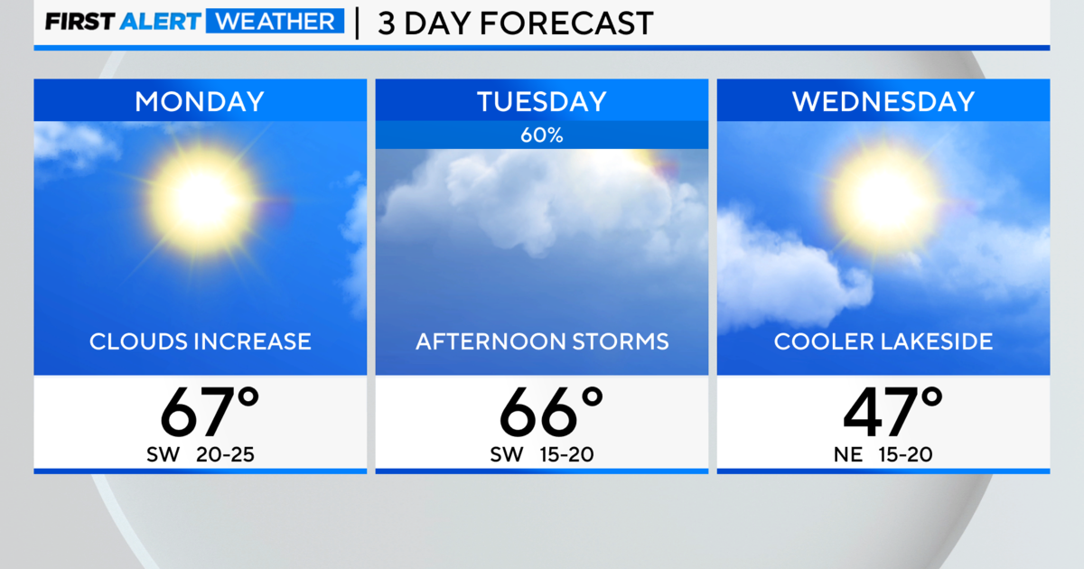
Temperatures could reach 90 in Chicago again on Tuesday, making it the fourth day in a row with a high of 90 or hotter. However, Tuesday is unlikely to be another record-setter.
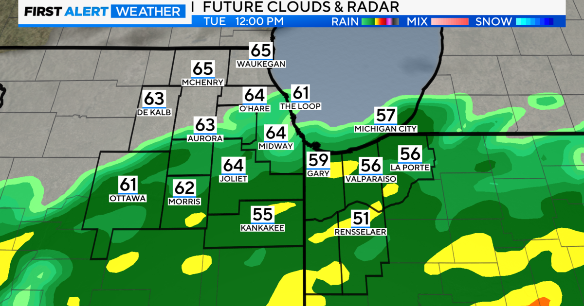
The next big weather threat for Chicago, rather, is heavy rain that is expected to begin falling late Tuesday or early Wednesday. Subtropical Storm Alberto made landfall Monday night along the Florida panhandle as a subtropical depression, and has been steadily moving north.
Remnants of that storm could bring 1 to 2 inches of rain to most of the Chicago area through Wednesday, with the potential for more than 2 inches in some areas, according to the National Weather Service. Flooding is possible in some areas.
The storms also will cool things off somewhat, with a high around 80 on Wednesday.
Thursday should bring a return to dry and hot weather, with partly cloudy skies, and a high around 91.
The end of the week also will bring significantly cooler weather, with a high of only around 70 on Friday, Saturday, and Sunday.