Saturday Forecast: Extremely Low Temperatures, Snow On The Way
CHICAGO (CBS)-- Chicago areas are experiencing extremely low temperatures with a high of only 13 degrees Saturday.
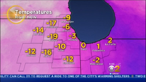
A quick round of light snow will move through Saturday night, bringing a half inch to an inch to most of the area. Temperatures in the mid 10s should drop to near 0 degrees overnight as the snow exits. Wind chills will be 5 to 15 degrees below zero.
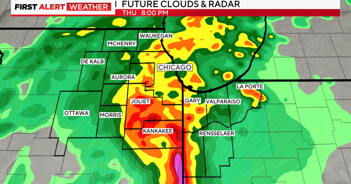
Snow to Develop Across The Area This Afternoon & Early Evening. Snow will Develop Across Much of N Illinois & NW Indiana During The Afternoon & Persist into The Early to Mid Evening Hours Before Endi... @cbschicago #inwx https://t.co/hhASwrcvEg
— Ed Curran (@EdCurran) January 26, 2019
Clouds will increase Sunday, but temperatures will remain cold. Highs will be in the mid 10s, and lows in the low 10s. Snow will move in overnight Sunday.
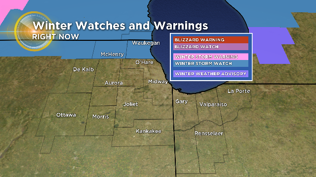
A Winter Storm Watch is already in place for Lake and McHenry counties from 9 p.m. Sunday to 6 p.m. Monday. This is likely to be upgraded to a Winter Storm Warning by Sunday. Additional warnings and advisories will also likely be posted.
Accumulating snow is likely, with the heaviest amounts falling before and during Monday's morning commute. The heaviest amounts will also likely be north, along the Illinois-Wisconsin state line.
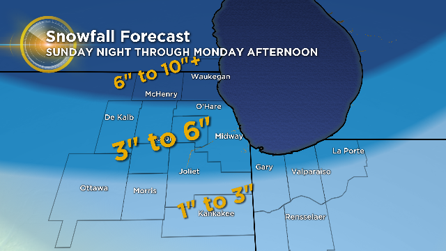
Most of Chicagoland is expected to receive 3 to 6 inches of snow with amounts of 1 to 3 inches south of I-80. The northern suburbs and north could possibly receive over 6 inches.
Snow will end in the late morning and afternoon with temperatures dropping after that.
Temperatures near 32 degrees on Monday afternoon will drop about 50 degrees by Wednesday morning.
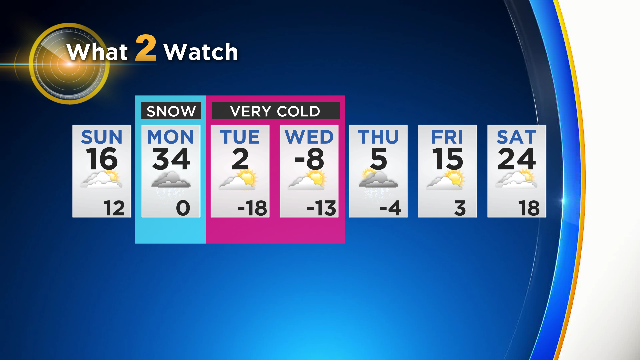
Highs may stay in the zero to minus 10 degree range on Wednesday with lows nearing 20 degrees below zero.
The coldest temperatures ever recorded in Chicago at O'Hare is minus 27 degrees . Some predictions indicate temperatures near that. Wednesday or Thursday morning.