Chicago Weather: Rain To Return In Days To Come
CHICAGO (CBS) -- Showers are expected to dissipate overnight Thursday into Friday, but later Friday, the rain will return.
Two rounds of active weather are expected.
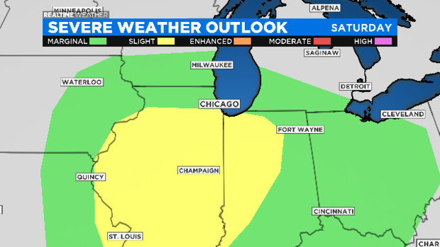
One is coming Friday night through Saturday morning It will mainly involve off-and-on heavy downpours, but a few stronger storms could be possible.
The other comes Saturday afternoon with stronger storms. It may contain isolated tornadoes or gusty winds.
On Thursday night, look for isolated showers with a low of 38.
On Friday, sowers and a few thunderstorms are possible in the afternoon picking up in the evening. Heavy downpours will continue off-and-on through Saturday morning. The high is 53.
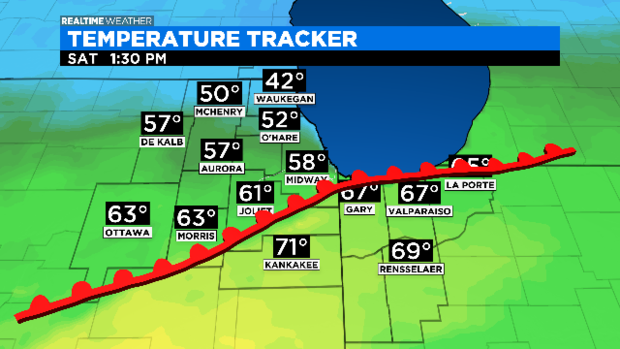
For Saturday, there will be heavy rain in the morning, then a break – with scattered showers through early afternoon. The high for Saturday is 62.
The better chance for severe storms arrives later Saturday afternoon (current timing is 2 p.m. to 6 p.m.).
Isolated tornadoes may be possible, especially Saturday afternoon, south of Chicago (think closer to Kankakee) along the warm front. Temperatures there may be in the 70s, while temperatures in the city are in the 50s. Any deviation of that front to the north will bring the storm chance into Chicago.
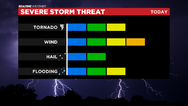
Heavy rain may lead to some minor flooding but widespread flooding isn't expected at this time.
Storms may also contain gusty winds and hail.
Showers will wrap up on Sunday and next week looks dry and mild.