Chicago Weather: Strong Storms Moving Through Tonight, Cooler Air Ahead Tomorrow
CHICAGO (CBS) -- Strong scattered storms could bring damaging winds and hail to the Chicago area Saturday night, as they move through the western suburbs toward northwest Indiana.
The National Weather Service has issued several severe thunderstorm warnings across the area Saturday night, including for parts of Will and Kankakee counties in Illinois and Lake, Porter, Newton, and Jasper counties in Indiana until 11:15 p.m.
There have been reports of 70 mph wind gusts, and quarter-sized hail. The storms are headed southwest, and largely expected to pass south of the city.
A few garden variety showers and thunderstorms are possible for the rest of the Chicago area, although things should clear up around midnight.
Tomorrow will be cooler than average, for the first time in more than two weeks, with partly to mostly sunny conditions, and a hit or miss shower or thunderstorm possible. Highs will be near 80 for most of the area, and the middle 70s near the lakefront.
Unseasonable warmth returns next week, when the best chance for thunderstorms will be on Wednesday.
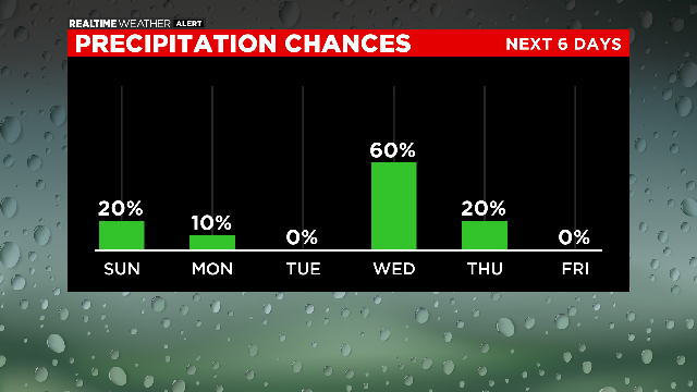
Otherwise next week will be mainly dry, with highs in the lower to middle 80s, but near 90 on Tuesday, and the lower 90s on Friday.