Chicago Weather: Tracking The Storm On New Year's Day
CHICAGO (CBS) -- A complex wintry system arrives New Year's Day and brings a little of everything – sleet, rain, freezing rain, and snow.
While the complexity may be high, the impact may be low to moderate. Also, impacts will be quite different across the area.
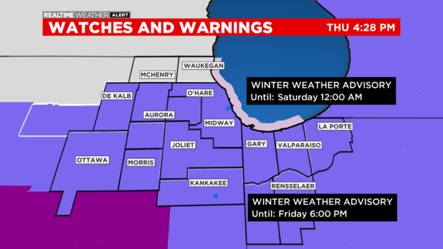
A Winter Weather Advisory is in place for all counties, except Lake County, Illinois and McHenry County. A previous Winter Storm Watch has been canceled.
On New Year's Eve night, it will be mostly cloudy with a low of 23.
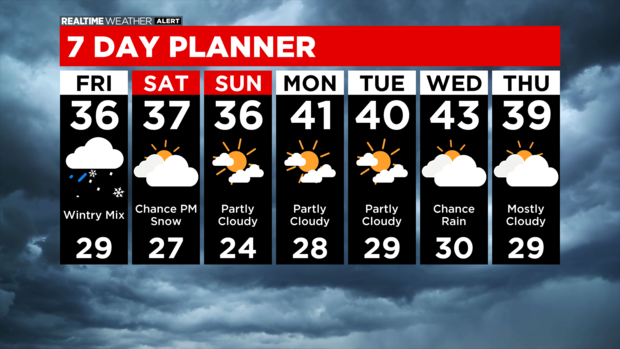
On New Year's Day morning Friday, snow begins to creep in from south and changes to sleet or freezing rain south of the city, but may remain snow northwest of city.
During the midday hours, all modes of precipitation are likely – sleet for some, freezing rain for others. Rain and snow are also likely across the area as well, with some locations seeing a mix of everything over the day.
On Friday afternoon, rain may be dominate for a period, as the icing wraps up and a more binary rain/snow system begins to exit.
On Friday evening, the system exits likely as briefly all snow, leading to minor accumulations.
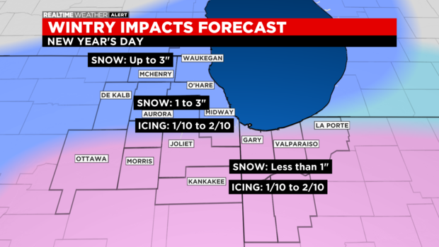
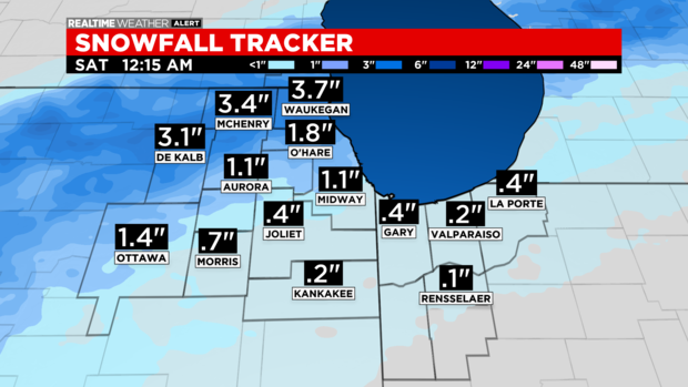
The snow will total 1 to 3 inches, with much lower totals for the city and parts south – as icing will eat into it.
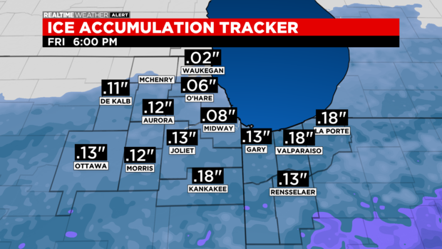
Some accumulations of less than an inch of sleet are also possible, as are a glaze of 0.1 to 0.2 inch of freezing rain.
A few snow showers may return late Saturday, but otherwise, the remainder of the forecast looks quiet.
Also From CBS Chicago: