Chicago Weather: Brutal Winds, Cold Moving In As Snow Moves Out
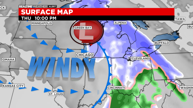
CHICAGO (CBS) -- More snow fell on the Chicago area Thursday before frigid temperatures were set to arrive overnight, ushering a brutal cold snap that is expected to stretch through the end of next week.
The National Weather Service has issued a Winter Weather Advisory through noon Friday.
On Thursday night, the last of the snow was moving out.
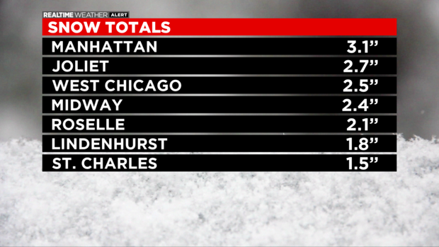
Snowfall totals reached 3.1 inches in the Will County community of Manhattan, 2.7 inches in Joliet, 2.5 inches in West Chicago, 2.4 inches at Midway International Airport, 2.1 inches in Roselle, 1.8 inches in Lindenhurst, and 1.5 inches in St. Charles.
Bitter winds are accompanying the Arctic front. Winds this evening have been gusting 40-50 mph.
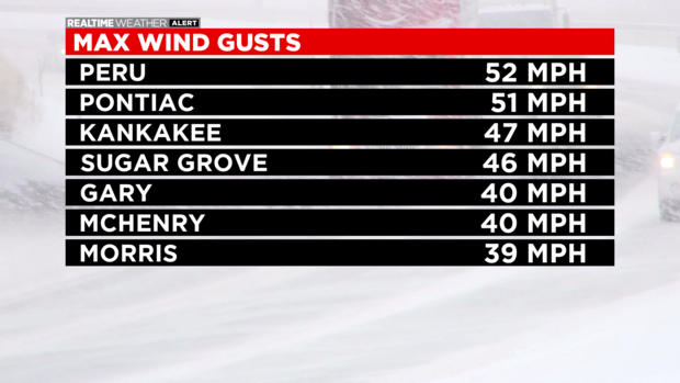
Winds gusted to 52 mph in Peru, 51 mph in Pontiac, 47 mph in Kankakee, 46 mph in Sugar Grove, 40 mph in Gary and McHenry, and 39 mph in Morris.
High winds are creating blowing snow, especially since the last of the snow is fluffier in nature. Expect poor visibility and hazardous travel Thursday night.
Wind chills Friday morning will be below zero.
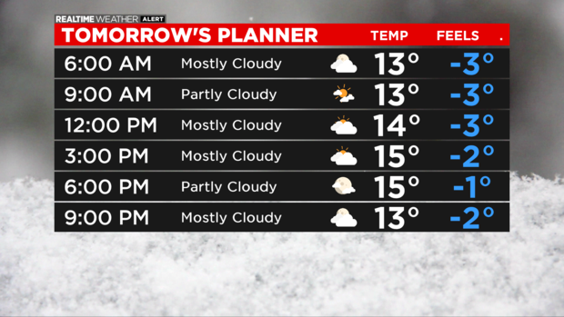
In fact, the feels-like temperature through the entire weekend will be at or below zero.
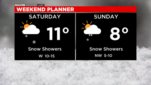
Snow showers develop Saturday with a few inches possible heading into Sunday.