Chicago Weather: Multiple Rounds Of Downpours, Storms Through Thursday
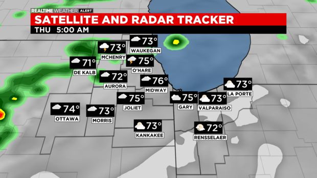
CHICAGO (CBS) -- A Tornado Watch is in effect to our west until midnight.
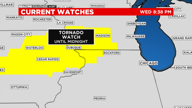
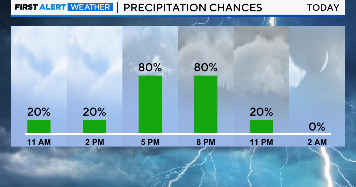
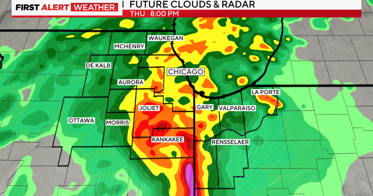
Storms from that area will head our way by daybreak and linger through rush hour. Any storms that form would be slow movers, creating a localized flood threat.
Once that wave moves through, we wait for the second round later in the day, during the heat of the afternoon. Storm intensity will depend on how our atmosphere recovers from the morning activity.
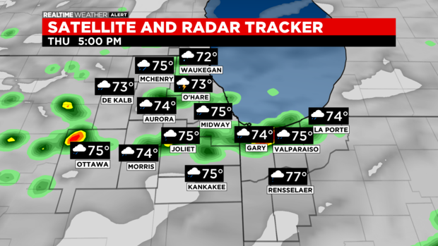
If we have lingering showers and clouds through midday with a cooler wind off the lake, that could help keep severe chances low. However, if we get any sunshine midday, that will help build the heat and humidity – and therefore, the instability – giving us a higher severe threat.
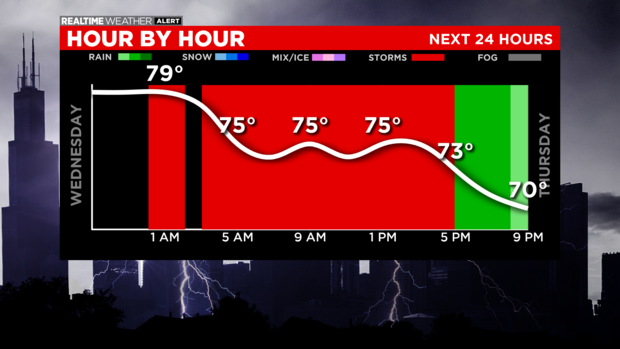
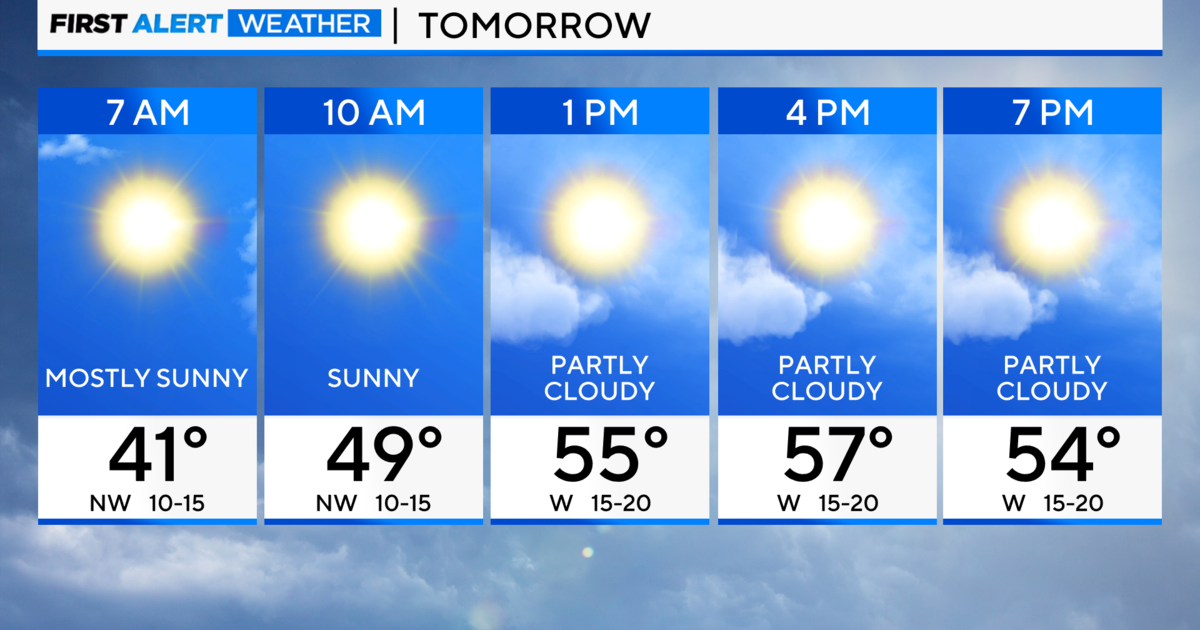
The low for Wednesday night is 72. The high for Thursday is 83.
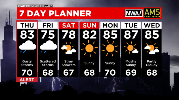
Rain lingers into Friday with clearing as we step into the weekend. The high for Friday is 75.