Chicago Weather: Arctic Blast Coming Late Tuesday Night
CHICAGO (CBS) -- An arctic blast of air arrives late Tuesday night, setting us up for a much colder weather pattern that will last for the next several days.
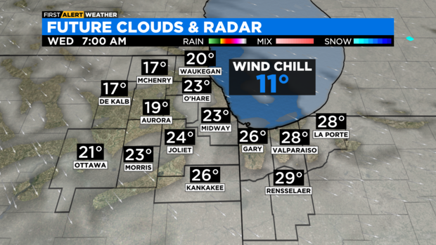
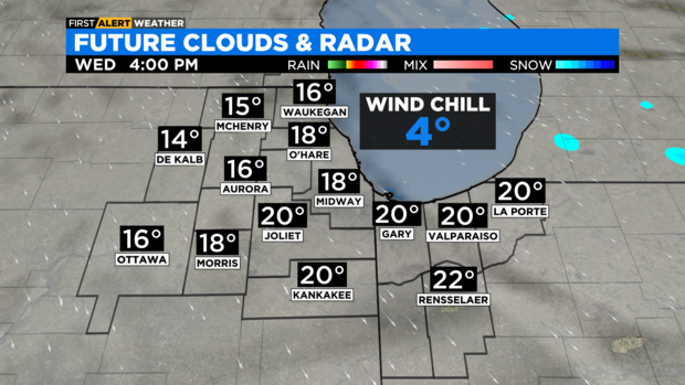
Temperatures on Wednesday morning will be in the low to mid-20s, but temperatures will drop throughout the day, ending up in the teens by Wednesday afternoon. A gusty northwest wind will produce wind chills in the single digits for Wednesday afternoon.
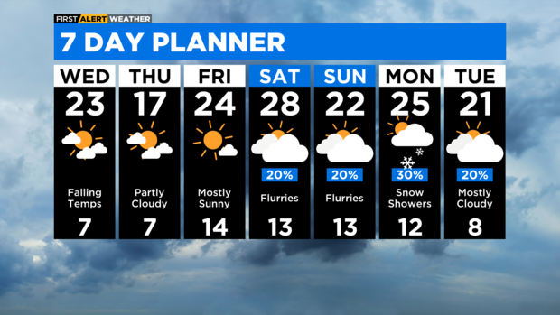
A north wind off the lake will produce heavy snow showers in parts of northwestern Indiana on Wednesday evening through Thursday. A Winter Storm Watch is in effect for Porter County, Indiana and LaPorte County for the threat of snowfall amounts exceeding six inches. Other than a few flurries, no snow is expected in northeastern Illinois.
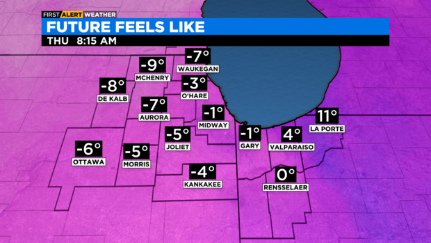
It will be very cold across the area for Wednesday night with lows in the single digits and wind chills below zero. Some spots will have wind chills as cold as -10° by Thursday morning.
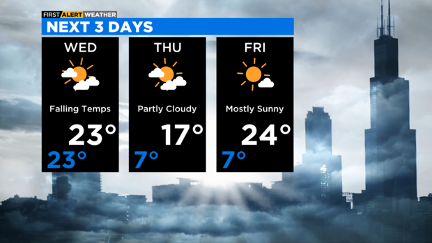
We'll be in the teens Thursday afternoon, then back to the single digits Thursday night. Highs will be in the 20s for Friday and this weekend. Weekend flurries and light snow possible. Scattered snow showers are in the forecast for Monday.
TONIGHT: Mostly cloudy and breezy. Low 23.
WEDNESDAY: Partly cloudy, windy and colder. High 23.
THURSDAY: Partly cloudy and cold. High 17.