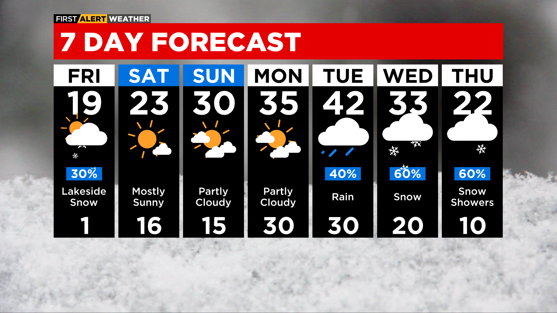
Chicago Weather Alert: Heavy Lake Effect Snow Possible Through Tomorrow Morning
CHICAGO (CBS) -- Heavy lake effect snow is possible starting tonight for parts of the Chicago area, making for a hazardous morning rush tomorrow.
Cloudy and mild conditions this afternoon will give way to a cold front moving in from southern Wisconsin, bringing spotty showers of flurries.
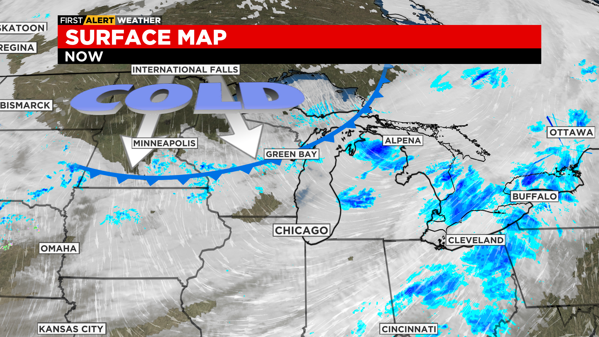
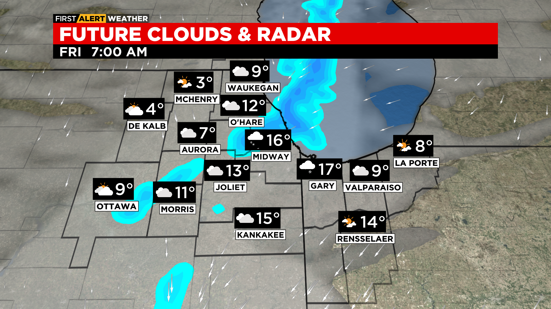
Once it's through, winds will turn northerly and lake effect snow starts to develop around 11 p.m. to midnight.
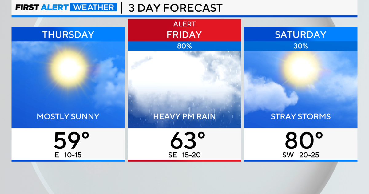
The National Weather Service has issued a winter storm watch for central and southern Cook County and in Lake County, Indiana, from midnight until noon Friday.
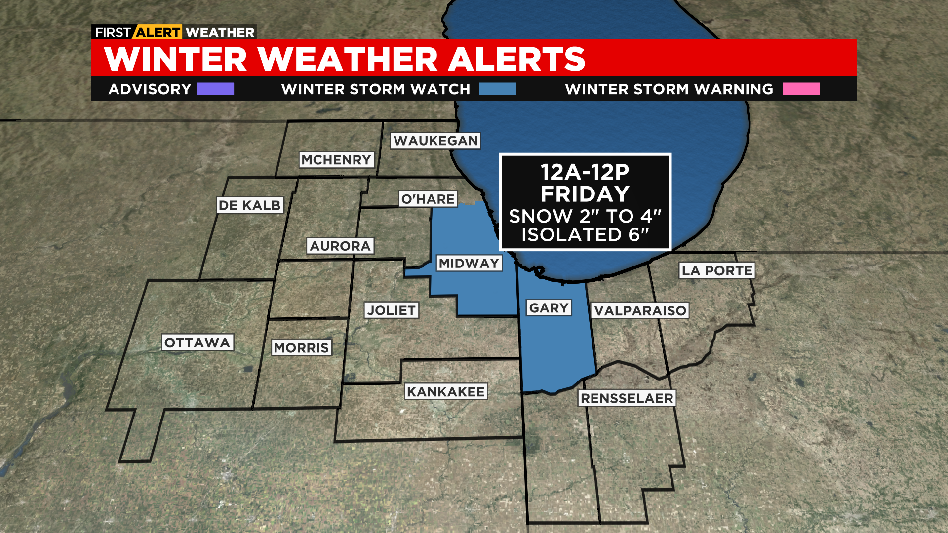
Total accumulations of 2 to 4 inches are likely for areas that see lake effect snow, with some isolated accumulations of up to 6 inches possible.
Snowfall rates could reach 1 to 2 inches per hour with any intense bands of lake effect snow that may form, and visibility will drop to less than a quarter mile at times.