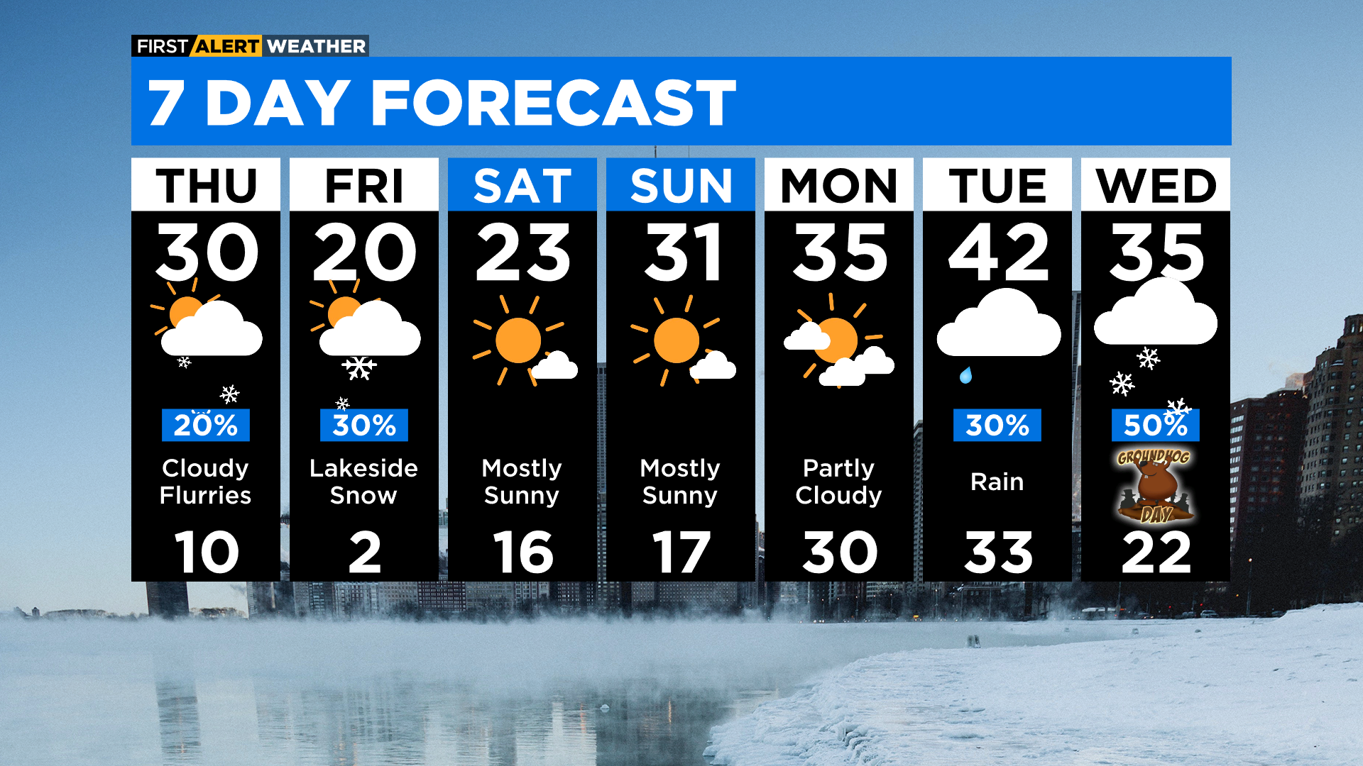
Chicago Weather: Temperatures Back To The 30s, Northwest Indiana Could Get 6 Inches Of Lake Effect Snow Tonight
CHICAGO (CBS)-- What a difference a day makes. A day after the coldest weather of the year, with temperatures dropping as low as 6 below zero on Wednesday, we're headed back to the 30s.
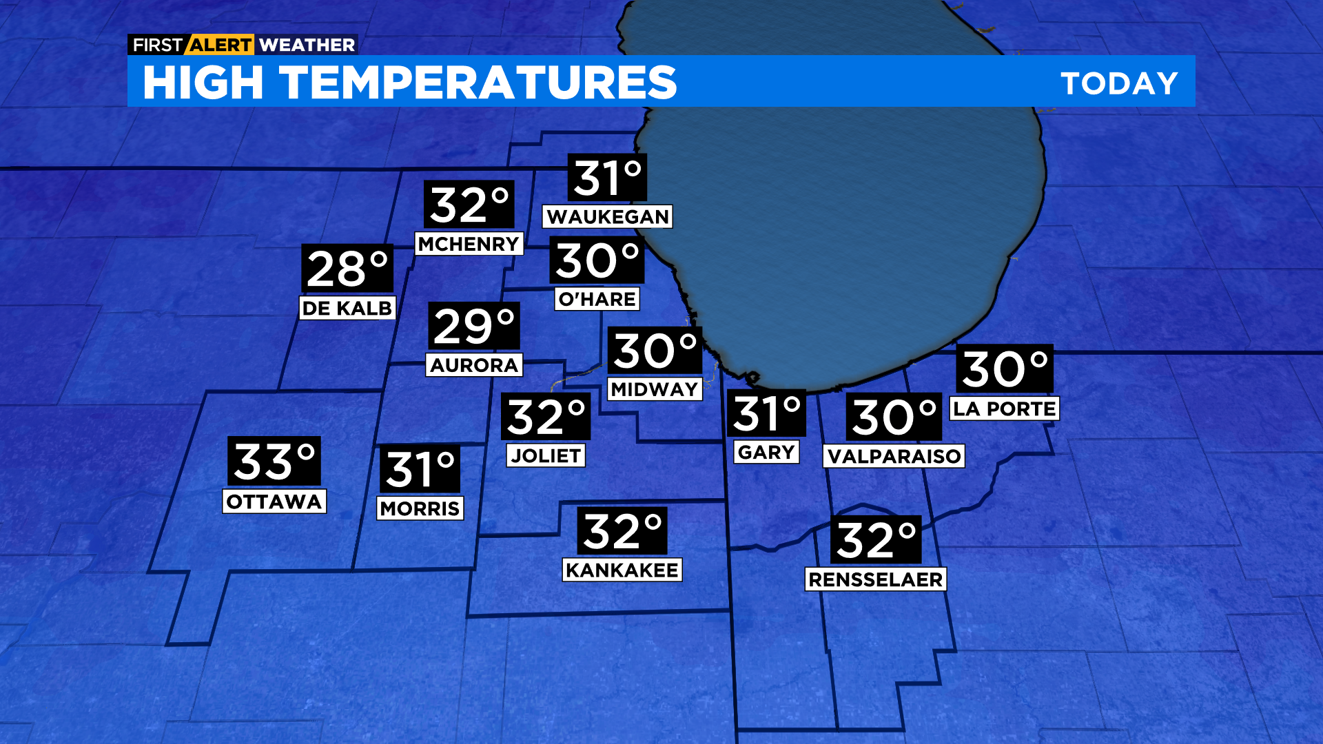
Thursday will be a breezy day with passing flurries and temperatures near 30°.
CBS 2 meteorologist Tammie Souza with the First Alert Weather says lake effect snow is expected to develop Thursday night. The snow will arrive between the lakeshore from Cook and Will counties and eastward to Lake and Porter counties in Northwest Indiana.
A very localized, but possibly high impact lake effect snow band could bring up to 6 inches of snow to Lake County, Indiana, where the National Weather Service has issued a Winter Storm Watch from 10 p.m. Thursday through 2 p.m. Friday. Drivers should expect slippery road conditions overnight, and hazardous conditions could hamper the morning commute on Friday, especially on Interstates 65, 80, 90, and 94. Snowfall rates of 1 to 2 inches per hour are possible, and visibility could be less than a half mile at times.
![]()
Lower accumulations are possible stretching from the Loop to Midway International Airport to Joliet and east into Porter and LaPorte counties, although Lake County, Indiana, is the only part of the Chicago area currently facing any winter weather advisories.
Otherwise, it will be sunny, breezy, and cold for inland counties.
Cold air returns Friday with temperatures in the 20s, and overnight lows near zero heading into Saturday.