Chicago First Alert Weather: Flood Watch Through Tuesday Morning
CHICAGO (CBS) -- A Flood Watch has been posted for much of the area for tonight through Tuesday morning, as heavy downpours could trigger flooding along creeks, streams, and rivers.
Ponding on roadways will also be possible.
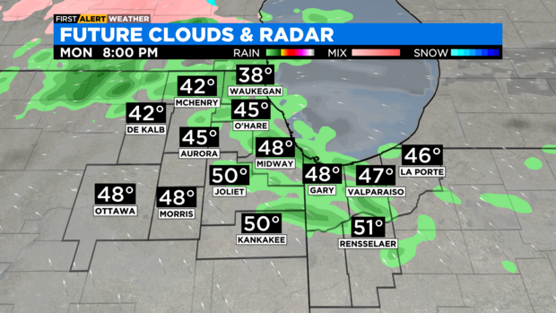
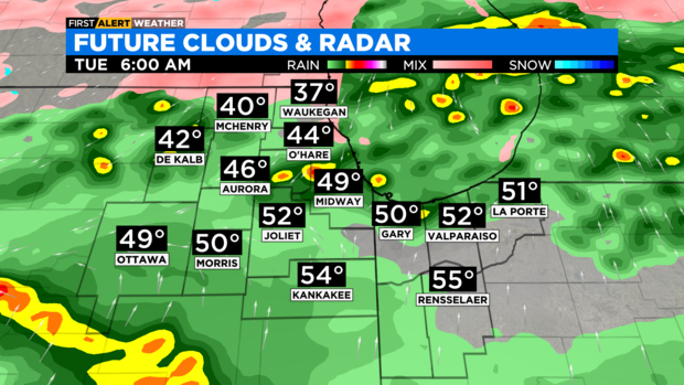
Drizzle and fog are coming Monday evening, and then showers and thunderstorms are likely overnight. Rain chances continue through much of Tuesday.
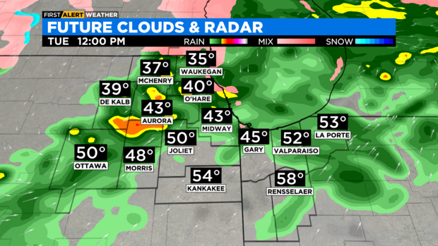
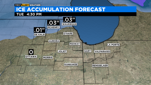
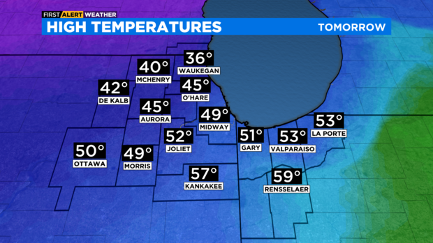
Some freezing rain is possible in parts of Lake County, Illinois, and McHenry County. Only minor accumulation of ice is expected. Highs on Tuesday will range from upper 30s to the north to near 60 degrees in the far south.
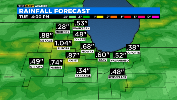
Highs in Chicago will be in the mid- to upper 40s. Rainfall amounts will mainly be between a half inch and three quarters of an inch. A couple of spots may see as much as an inch.
It will be mostly cloudy, breezy, and turning colder for Tuesday night. Lows will be in the teens.
It will be breezy and cold for Wednesday with highs in the mid-20s. A few snow showers will be possible Wednesday night.
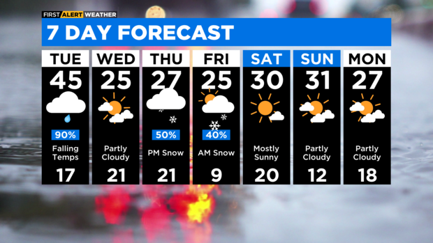
Snow shower chances increase Thursday afternoon through Friday morning. A few inches of accumulation will be possible.
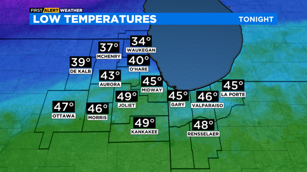
TONIGHT: Cloudy with areas of fog and showers. A few thunderstorms and downpours are possible overnight. Low 40°
TUESDAY: Cloudy and foggy with showers likely. Some freezing rain is possible, but mainly for areas north and northwest of Chicago. High 45°
WEDNESDAY: Partly cloudy, breezy and much colder. High 25°