Storm, 'Rain-Snow Mix' Headed Toward Chicago
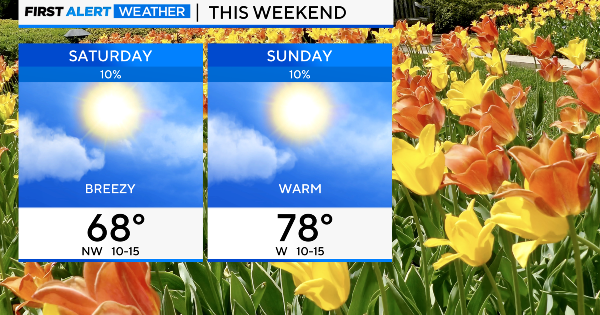
CHICAGO (STMW) --High temperatures throughout the weekend – including the first 80-degree day of the year Saturday – were only temporary, as a storm system moving in Sunday afternoon could bring at least 12 hours of steady rainfall and a rain-snow mix to the Chicago area.
Rain with scattered thunderstorms should begin falling across northern Illinois between 2 p.m. and 4 p.m. Sunday, and is not forecast to stop until late Monday afternoon, according to National Weather Service Meteorologist Andrew Krein.
Bringing with it a cold front, scattered thunderstorms and fog — visibility could be reduced to less than a mile in areas near the lake — the storm is expected to drop up to 3 inches of rain before it tapers off, he said.
As temperatures fall, the Chicago area may even see "a rain-snow mix" by Monday afternoon, Krein said.
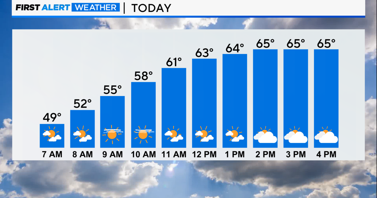
Temperatures peaked Sunday morning in the high-60s, and by 11:30 a.m. had already began to fall, he said.
The approaching storms delayed the White Sox Sunday afternoon game against the Cleveland Indians, according to the team's official Twitter feed. First pitch, originally slated for 1:10 p.m., was tentatively rescheduled for 2:25 p.m., the team announced.
Officials said storms reaching U.S. Cellular Field about 1:30 p.m. could last as long as 90 minutes.
As the storm moves through the area, high temperatures overnight and Monday are expected to be in the low 40s, Krein said.
Albeit drier, Tuesday will likely be just as cold, he said. Temperatures are not forecast to surpass 40 degrees.
(Source: Sun-Times Media Wire © Chicago Sun-Times 2014. All Rights Reserved. This material may not be published, broadcast, rewritten, or redistributed.)