Image Shows Early Chicago Along South Bank Of River
By John Dodge
CHICAGO (CBS) -- About 40 years before the Great Chicago Fire, this village along the shores of Lake Michigan essentially consisted of a muddy trail along the south bank of the Chicago River along with a few small streets, which today comprise the epicenter of the Loop.
In what may be one of the first images of Chicago (above), a general store, along with a horse-drawn carriage, sits along the bank of the river. Off in the distance is Wolf Point Tavern.
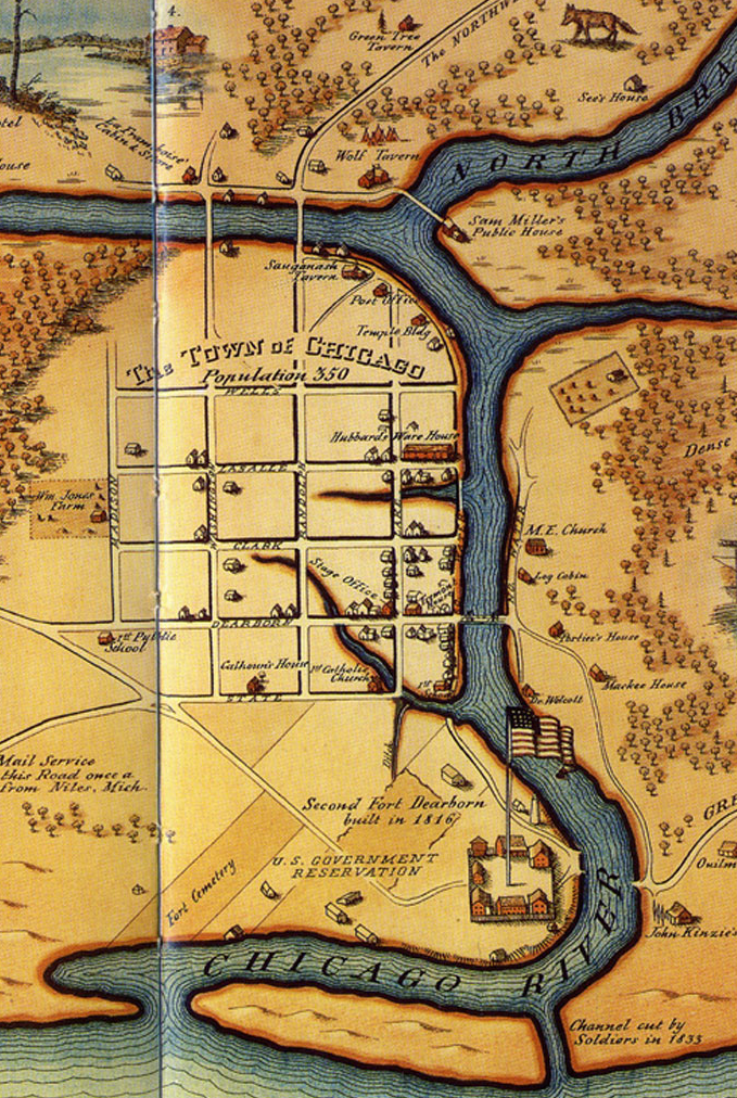
The image, which is featured on a Chicago history website called Chicagology, apparently was from the 1830s. It was published in a 1929 book titled "Chicago and Its Makers."
Today, that trail is Wacker Drive.
The picture above is a rare view looking west toward Wolf Point (where the river splits) on what was then known as South Water Street, according to the website's owner, Terry Gregory.
In 1833, when Chicago was officially chartered as a village, the population was around 350. Four years later, nearly 4,000 residents called Chicago their home.
Chicagology focuses on the history of the city before 1900, Gregory says.
A sixth-generation Chicagoan, Gregory, who now lives in Hawaii, has always been interested in Chicago history. Part of his family settled here in the 1850s.
Jerry Cwick's family tree dates back to the time of this scene. He likes to imagine his ancestors walking along the trail, and it was quite likely that they did.
More family members settled in Chicago from Ireland in 1845. His great, great-grandfather started a shipbuilding businesses located on the site of what is now the University Of Illinois at Chicago, Cwick said.
Tragically, he lost virtually everything in the 1871 fire.