Chicago Weather: Rain Wrapping Up, Get Ready For Hot Monday
CHICAGO (CBS) -- A second round of storms slid through Illinois late Sunday afternoon, actually bringing a tornado warning to Logan County, in central Illinois, at one point.
The rain was less impressive to the north as a warm front moves up into the area. The last of the rain wraps up during the early hours of tonight. The rain will be gone but it won't feel like pumpkin spice season as we start the work week.
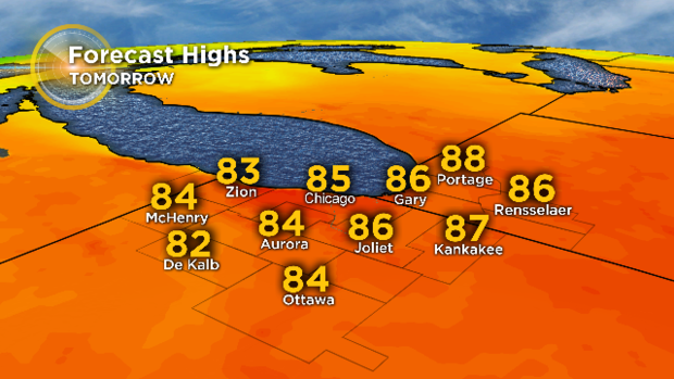
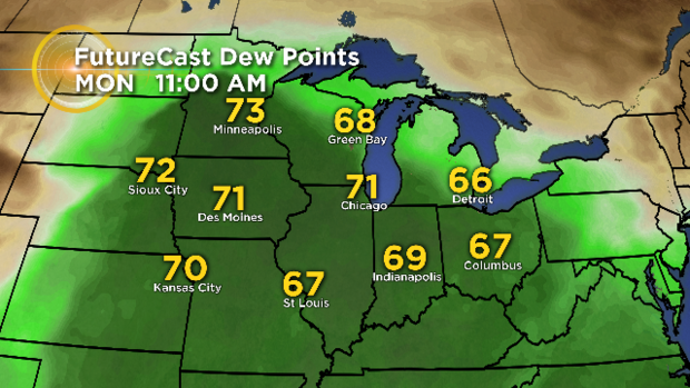
We close September with a warm and more humid Monday. We may begin the morning with some areas of fog. Warm air being transported into Chicago brings us dew point temperatures in the low 70s and will cause temps to actually rise during Sunday night. That, together with an air temperature in the middle 80s and plenty of sunshine, all add up to summerlike weather on Monday.
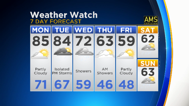
We'll see warm air stay in place for a second day, Tuesday the 1st of October, but an approaching change in air mass can trigger some PM showers and storms. This opens the door for more autumnal air to slide into Chicago, bringing rain midweek and temperatures that'll go from 16 degrees above normal on Monday to about 6 degrees below normal by Friday.
Forecast:
Monday: Sunny and warm with a high of 85. Breezy SW wind of 15 gusting to 25.
Monday Night: Some clouds, mild, low around 70.
Tuesday: Partly sunny and still warm. PM showers and storms possible. 84.