Chicago Weather: Thursday Marks Chicago's Snowiest Halloween Ever
CHICAGO (CBS) -- No, you did not fall asleep Rip Van Winkle-style and wake up in February – it is, in fact, Halloween, and a Halloween with record-setting snow for the date in Chicago.
As of 5 p.m., a whopping 3.4 inches of snow had fallen at O'Hare International Airport.
There have only been six Halloweens when it has snowed since 1881. The most recent time in 2014, there was only 0.1 inch.
Some other parts of the area got socked far harder than the city on Thursday. Snow topped out at 7.1 inches in Bull Valley, 7 inches in Woodstock, 5.8 inches in Highwood, 5.4 inches in Rolling Meadows, 5.1 inches in Medinah, and 5 inches in South Elgin and Des Plaines.
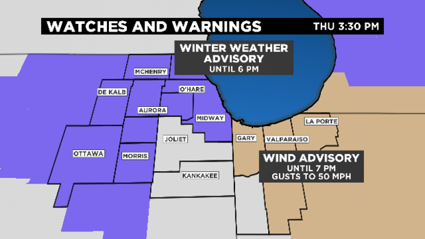
A winter weather advisory remains in effect for the city and nearby suburbs until 6 p.m.
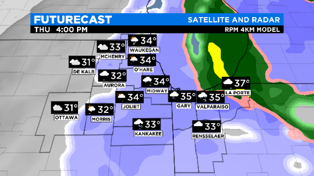
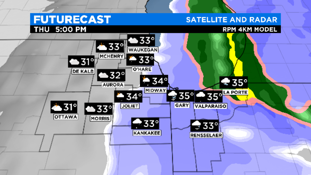

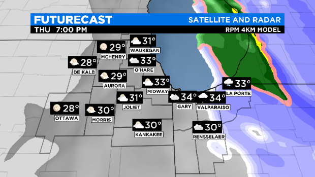
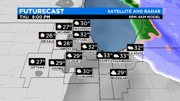
CBS 2 Meteorologist Megan Glaros reported the snow will be hovering over the area through the afternoon, until the 5 p.m. hour when it starts to move out. Temperatures will hover just above the freezing mark until the evening, when they will dip to 32 at O'Hare and Midway and the upper 20s in parts west.
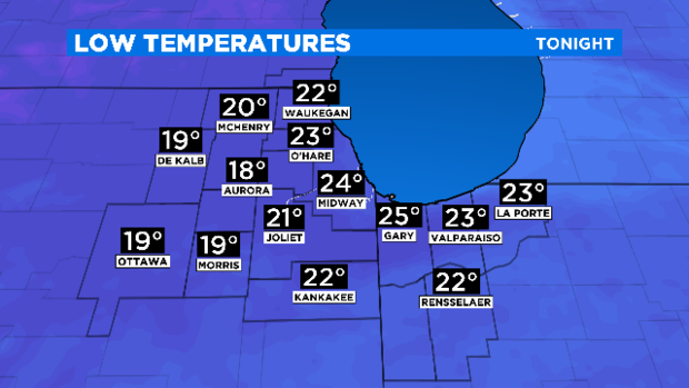
Overnight, the temperatures will drop to hard wintry lows of 24 at Midway, 23 at O'Hare, and a mere 18 in Aurora.
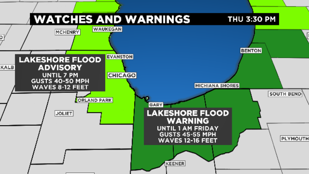
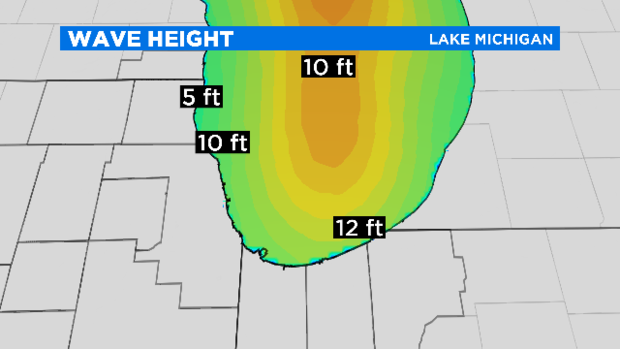
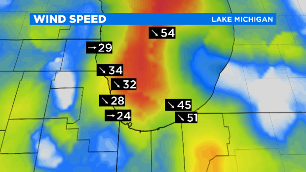
A lakeshore flood advisory also remains in effect until 7 p.m. for Cook County and points north along the lake into Wisconsin, amid concerns about wind gusts of 40 to 50 mph and waves of 8 to 12 feet.
But for Lake, Porter, and LaPorte counties in Indiana as well as lakefront southwest Michigan, a lakeshore flood warning has been issued until 1 a.m. Friday – for gusts of 45 to 55 mph and waves of 12 to 16 feet.
Trick-or-treating has been postponed for some Chicago suburbs.
Meanwhile, does it seem like the last time it snowed was not that long ago, with wintry blasts only separated by a brief respite of summer? That's not quite what happened, but it's not far off.
The National Weather Service notes that 2019 does rank in the top 10 among years with the shortest periods between cold-season snowfalls. There were 185 days between the springtime snowfall that socked the city on April 29, and the snow that fell for much of the area on Wednesday.
But the record was set 30 years ago in 1989. That year, the last snowfall for the long-lingering winter season came on May 6, and snow came again only 164 days later on Oct. 18.
However, the amount of snow in both of those events was comparatively modest – 0.5 inch on May 6, 1989, and 0.7 inch on Oct. 18. This year, there were 2.5 inches of snow on April 27, and 1.2 inches at O'Hare on Wednesday.
On average, the first measurable snowfall of 0.1 inch or more comes on Nov. 17, while the first snowfall of 1 inch or more does not come until Dec. 7. But the first trace of snow actually comes on average on Oct. 30.