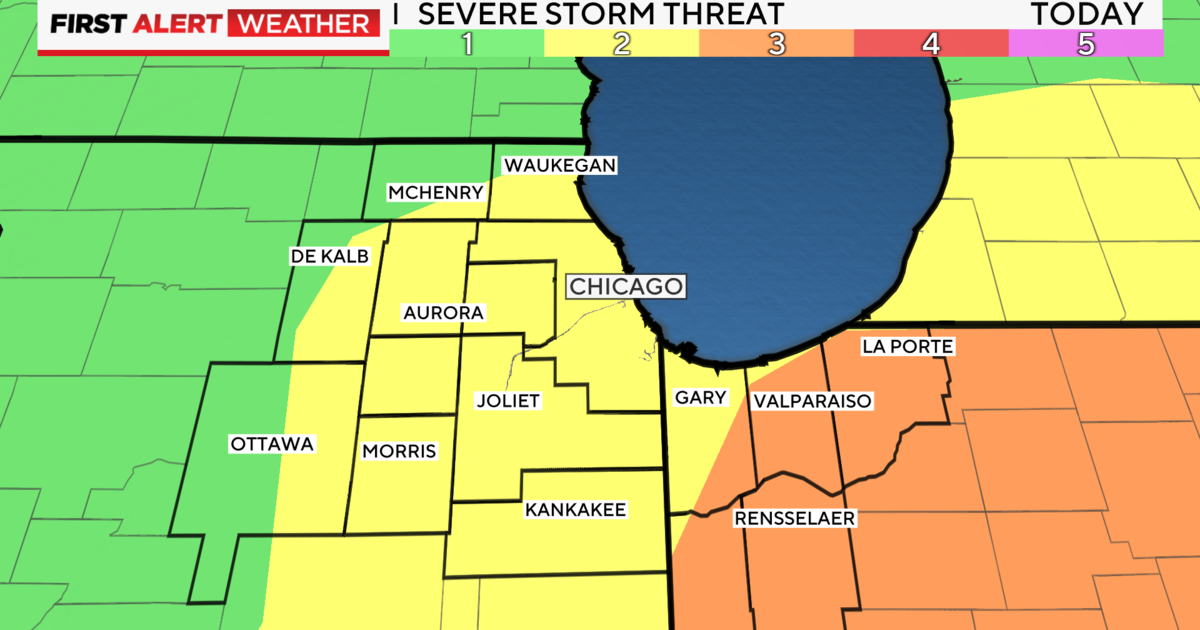
Chicago Weather: Terrible Timing For Our Next Wintry Mix
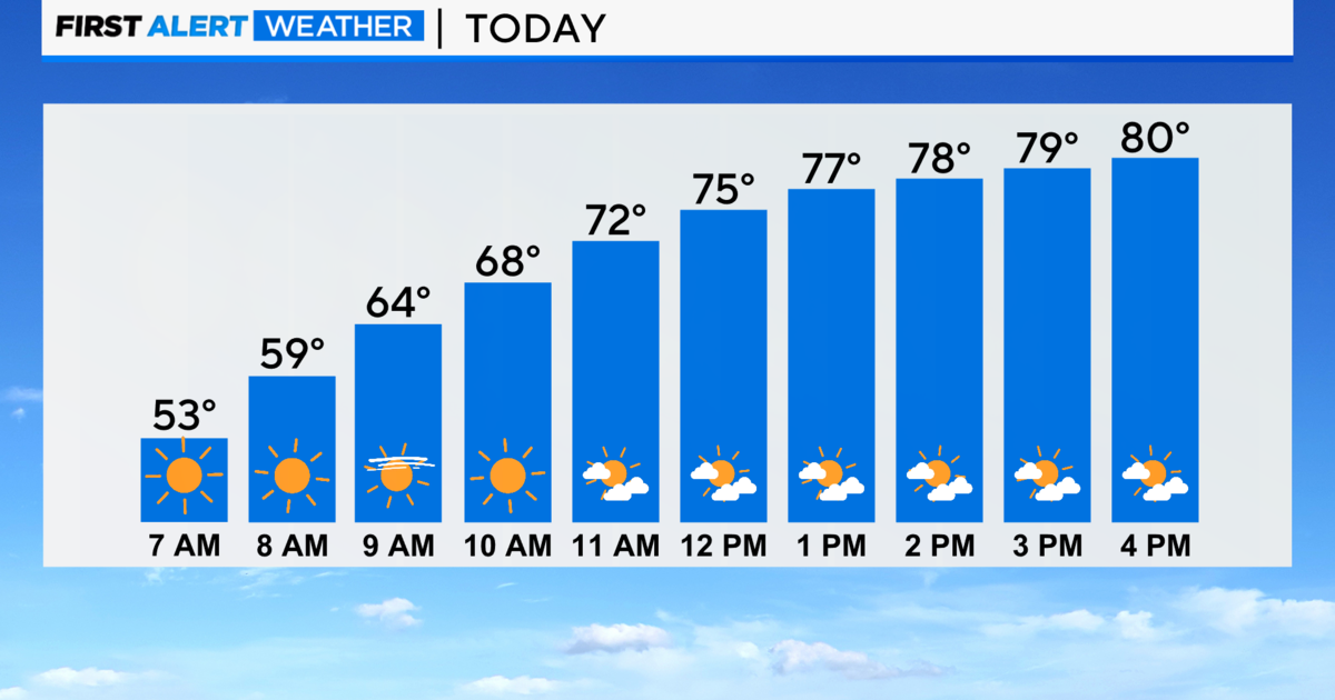
CHICAGO (CBS) -- Light snow is on the way for the Wednesday morning rush.
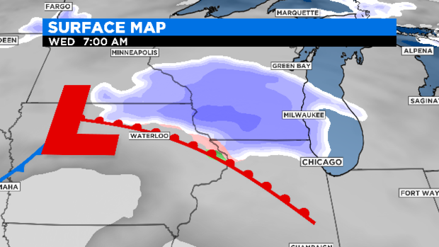
The snow will move in by 3 a.m. in the western suburbs and fill into the immediate Chicago area during the morning rush.
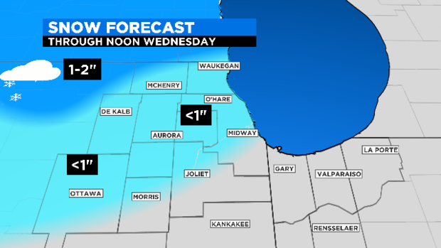
Slushy accumulation up to one inch is possible for areas north of I-80. The best chance for accumulation will be closer to the Wisconsin state line.
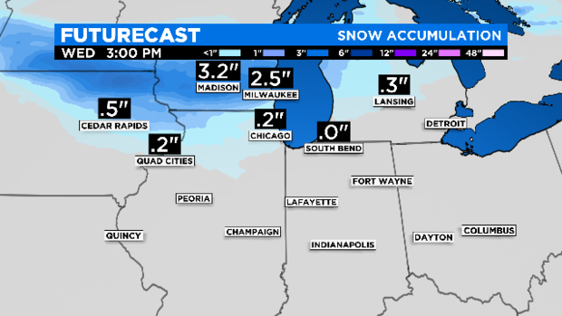
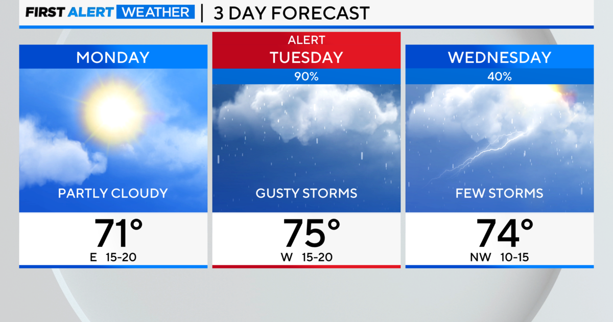
This first batch of precipitation will develop ahead of the approaching warm front. By mid-morning, temperatures will rise above freezing and snow will mix and then change over to all rain. Clouds and rain showers will linger in the late afternoon hours.
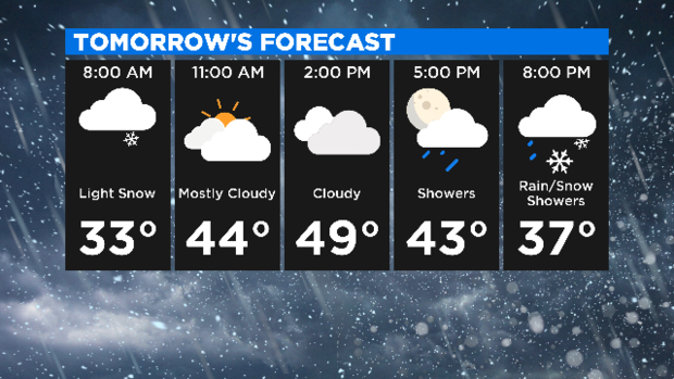
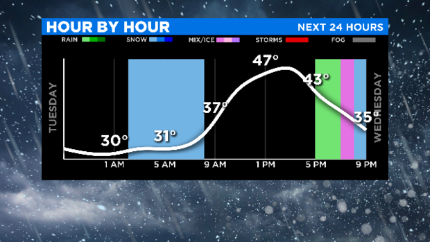
We expect another round of rain and snow after sunset and through the night Wednesday as the main cold front pushes east of our area. Wednesday night rain changes back to light snow. A few snow showers may linger early Thursday morning. This front opens the door to a push of cold air for Thursday and Friday with highs near the freezing mark.
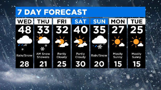
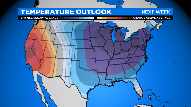
Peeking ahead to next week... an Arctic front will pass through Chicago Sunday bringing an unseasonably cold air mass, possibly record-breaking for early next week. Temps next week will remind you of how it feels during the heart of winter.