Chicago Weather: Threat Of Heavy Snow Shifts To Southeast
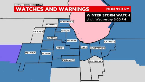
CHICAGO (CBS) -- The threat of heavy snow beginning Tuesday has shifted to the south and east – prompting the cancellation of a Winter Storm Watch for DeKalb and McHenry counties.
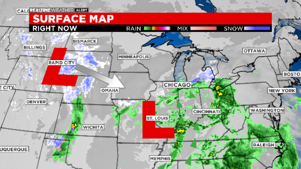
Our first area of low pressure was nearby Monday night, pulling in moisture from the Gulf of Mexico. As the second low heads our way, it drags cold air to meet the moisture in place – creating accumulating snow chances.
Due to the timing of the cold air arrival, a Winter Storm Watch goes into effect Tuesday afternoon for most of the area.
Rain showers late Monday may mix with a little snow before a break in activity after midnight.
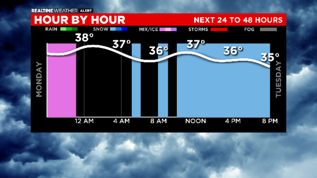
For the Tuesday morning rush, there may be a few rain or snow showers around. Temperatures may actually be above freezing during the day.
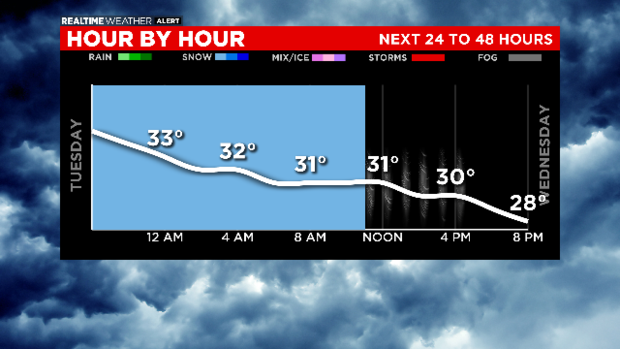
Better chances for snow showers are expected Tuesday afternoon, but highest time frame for accumulating snow is after dark Tuesday into Wednesday morning.
We are still watching the storm track. As of Monday night, models continued to favor areas south of Chicago and into Northwest Indiana for the highest totals of 3 to 6 inches.
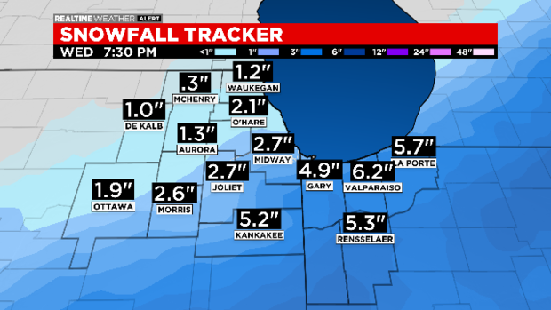
Totals of 2.7 inches are anticipated at Midway International Airport, and 2.1 inches at O'Hare International Airport.
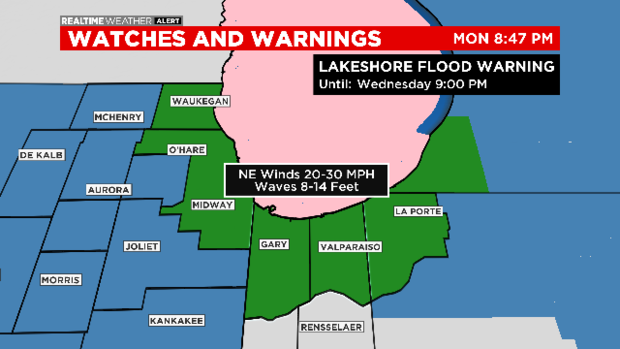
High winds will create waves 8 to 14 feet. Lakeshore Flood Warnings have been issued for all area shore lines.