Chicago Weather: Winter Weather Advisory At 11 a.m. Thursday
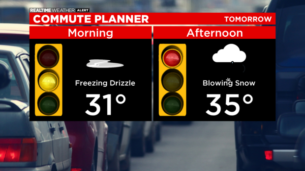
CHICAGO (CBS) -- Patchy freezing drizzle is possible during the morning rush, creating slick spots on area roads.
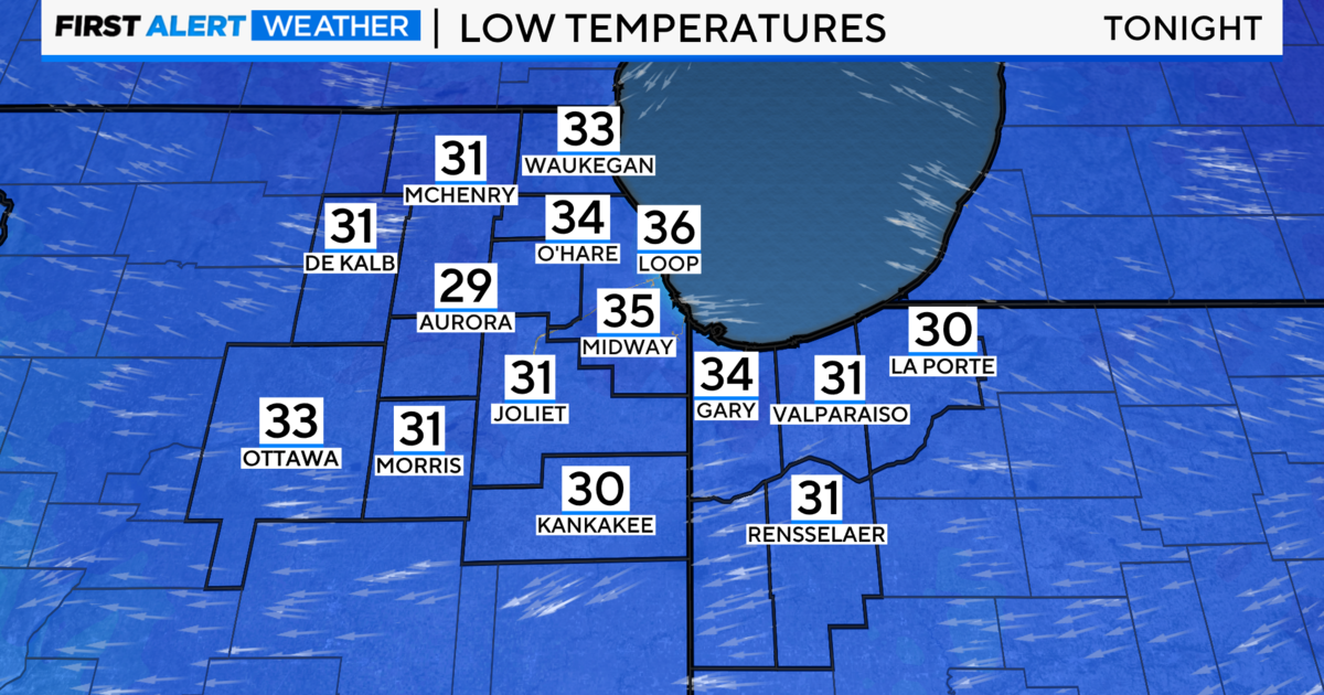
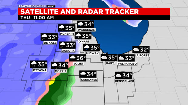
After a low in the mid-30s on Wednesday night, the high for Thursday is in the mid-30s.

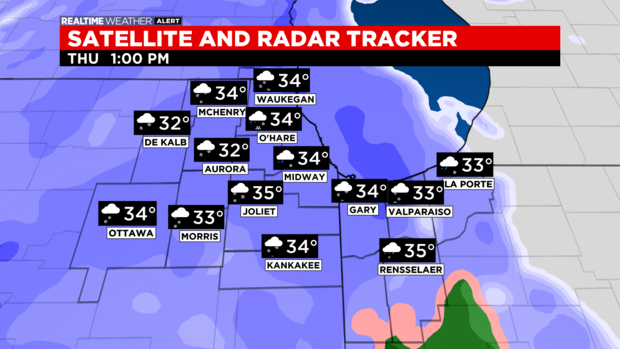
By midday, the main precipitation shield moves in. Expect a mix at first of freezing rain, rain, sleet, and snow.
The mix quickly changes to all snow by early afternoon. 2 to 5 inches of snow possible. Some models show isolated 6-inch totals. It really depends how quickly we change over to snow.
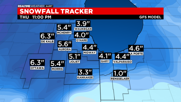
The best accumulation will be north of I-80. The evening rush will be a mess, with blowing snow as winds may gust to 40 mph.
Poor visibility and snow-covered roads will really slow down the commute.
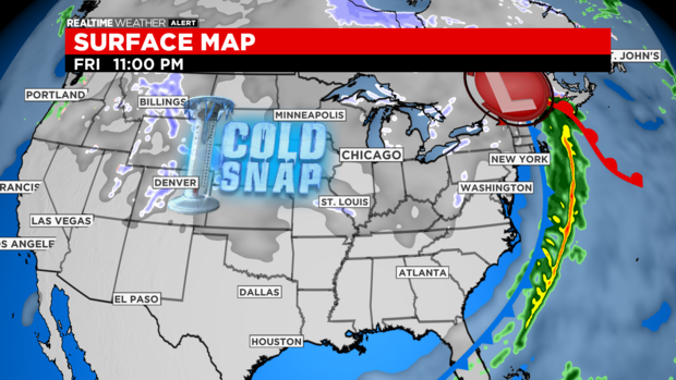
It's important to clear snow from driveways and sidewalks tomorrow evening before the Arctic air arrives. Otherwise, you'll end up with an ice cap of a driveway.
Snow should taper off by 10 p.m.
With the gusty winds lingering into the Friday morning commute, we will likely have blowing snow and poor visibility.
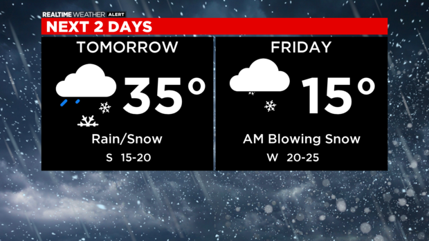
Temperatures will be falling through the day Friday, when the high is just 15.
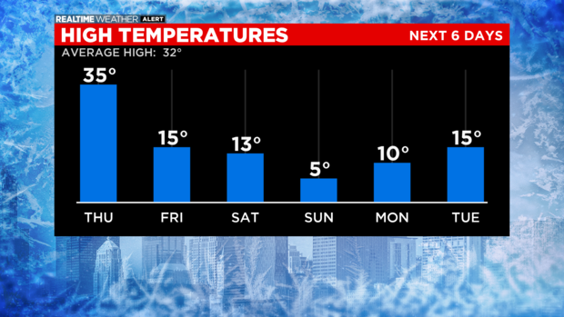
There will be a bitter blast this weekend. The Arctic air mass stays in place through next week.
Also From CBS Chicago: