Chicago First Alert Weather: Mild Temps Over The Next Few Days
CHICAGO (CBS) -- Flurries taper off Monday afternoon as the weak disturbance overhead moves away.
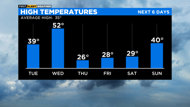
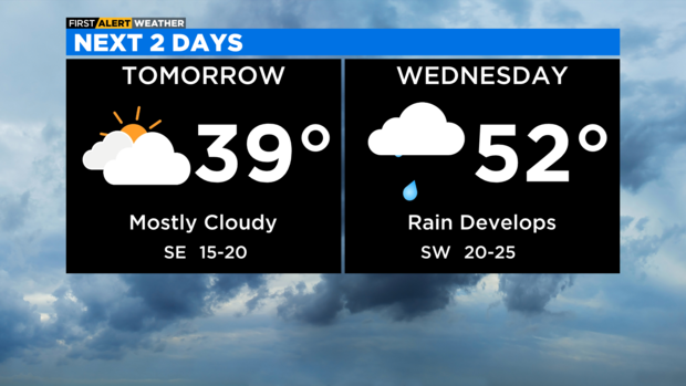
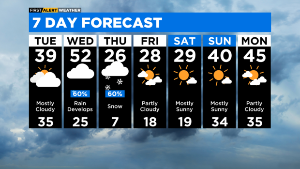
According to CBS 2 meteorologist Mary Kay Kleist, milder air moves our way over the next two days. Normal high is 35 degrees. Temperatures will reach near 40 Tuesday and 50 by Wednesday.
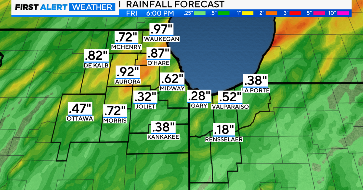
The next system will bring rain by Wednesday afternoon. Heavy rain is expected heading into Wednesday night, with rainfall totals of one to one and a half inches possible, especially south of I-80. This will create rapid melting of our snowpack.
Since the ground is frozen, rain will run off into area rivers, which are partially ice covered. The warm air followed by quick rises in stream flow could create ice jam flooding.
Arctic air invades our area starting Thursday. As it moves in, Wednesday night into Thursday morning could be icy, with freezing rain, sleet & ice accumulation as the cold air rushes in. During the day Thursday we have snow chances. Models are not in agreement on the storm track. It's still too soon.
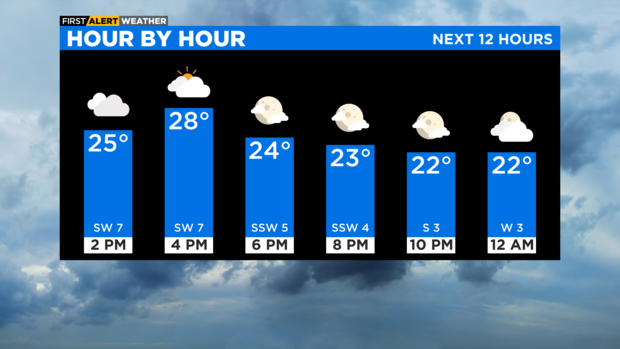
TONIGHT: Mostly cloudy. Low 19.
TUESDAY: Mostly cloudy. Not as cold. High 39.
WEDNESDAY: Rain develops. Mild. High 52.