Chicago Weather: Severe Storms To Sweep Across The Area
CHICAGO (CBS) -- A line of slow moving storms may develop into severe storms Monday afternoon and sweep across our area into the evening.
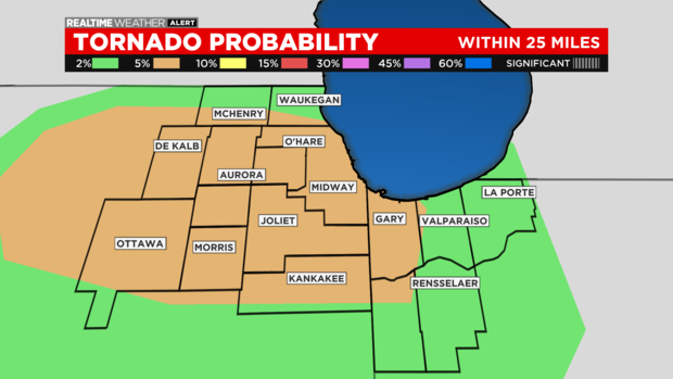
A pair of tornado warnings were issued in DeKalb county around 4:30 p.m. At least two possible tornadoes were spotted, including one near Kirkland and another near Monroe Center.
According to CBS 2 meteorologist Robb Ellis, the line will begin to develop more distinctly between 4:00 p.m. and 5:00 p.m. and likely continue sweeping across the entire viewing area through 9:00-10:00 this evening.
A tornado watch has been issued until 10 p.m.
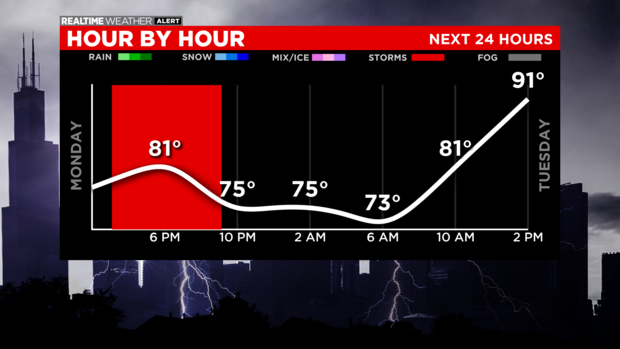
The greatest potential for severe storms appears to be between 5:00 p.m. and 8:00 p.m. An ongoing flooding threat may persist through midnight.
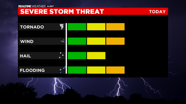
The line of storms will likely contain gusty winds and a few tornadoes are possible. Because the storms are slow moving, there may be some localized flooding.
The threat is greater later in the evening between 7:00 p.m. and 10:00 p.m. and farther south (south Chicago to Kankakee to northwest Indiana.
The primary threat includes gusty winds. The secondary threat has tornadoes and flooding.
There is a possibility of severe thunderstorm warnings by the evening newscasts. A tornado warning or two cannot be ruled out. Flash flood warnings will begin to emerge as the dominate threat. Heavy downpours will occur in a short time.
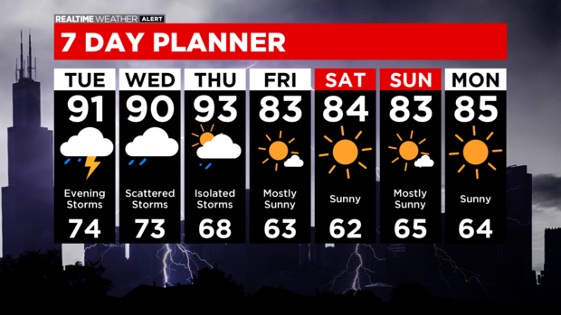
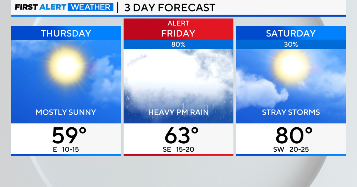
It'll be steamy and stormy through Thursday with another round of strong storms possible on Tuesday night.
And it'll be slightly cooler but much drier weather by Friday through the weekend.